DroneCamp 2021, July 26-30. More info.
Mission Planning Exercise
https://youtu.be/szjUf4UW6vY
In this exercise, your job is to design flights to map 400 acres of a nature reserve using a Phantom 4 Pro for a long-term environmental monitoring program. Challenges to overcome include :
- You have to think about what GSD (resolution) is needed to meet the project goals
- The area is too big to complete in one flight
- The area is hilly and forested, which will constrain your options for launch points
- Since you’ve never been there, you need to refer to local maps as well as your mission planning app
Scenario
The head research biologist at Hastings Natural History Reservation [map] in Monterey County, California has asked you to collect imagery with a drone for a long-term vegetation monitoring program. The monitoring program has both management and research goals, including:
- detecting tree mortality
- modeling habitat connectivity
- developing hydrological models
- modeling wildfire dynamics & planning fire control strategies
- tracking feral pig damage
- monitoring illegal activities (e.g., unauthorized camping, pot growing, dumping)
Study Area
The monitoring area is ~400 acres in the central part of Hastings Reserve, to the east of Big Creek and north of Robertson Creek (see red outline below, also links to web maps). The area is hilly and there are two peaks in the monitoring zone. The vegetation is dominated by oak woodland with open grassy areas (and a lot of poison oak). There are roads along the southern and western boundaries, and an access road to the Robertson House on the eastern side.
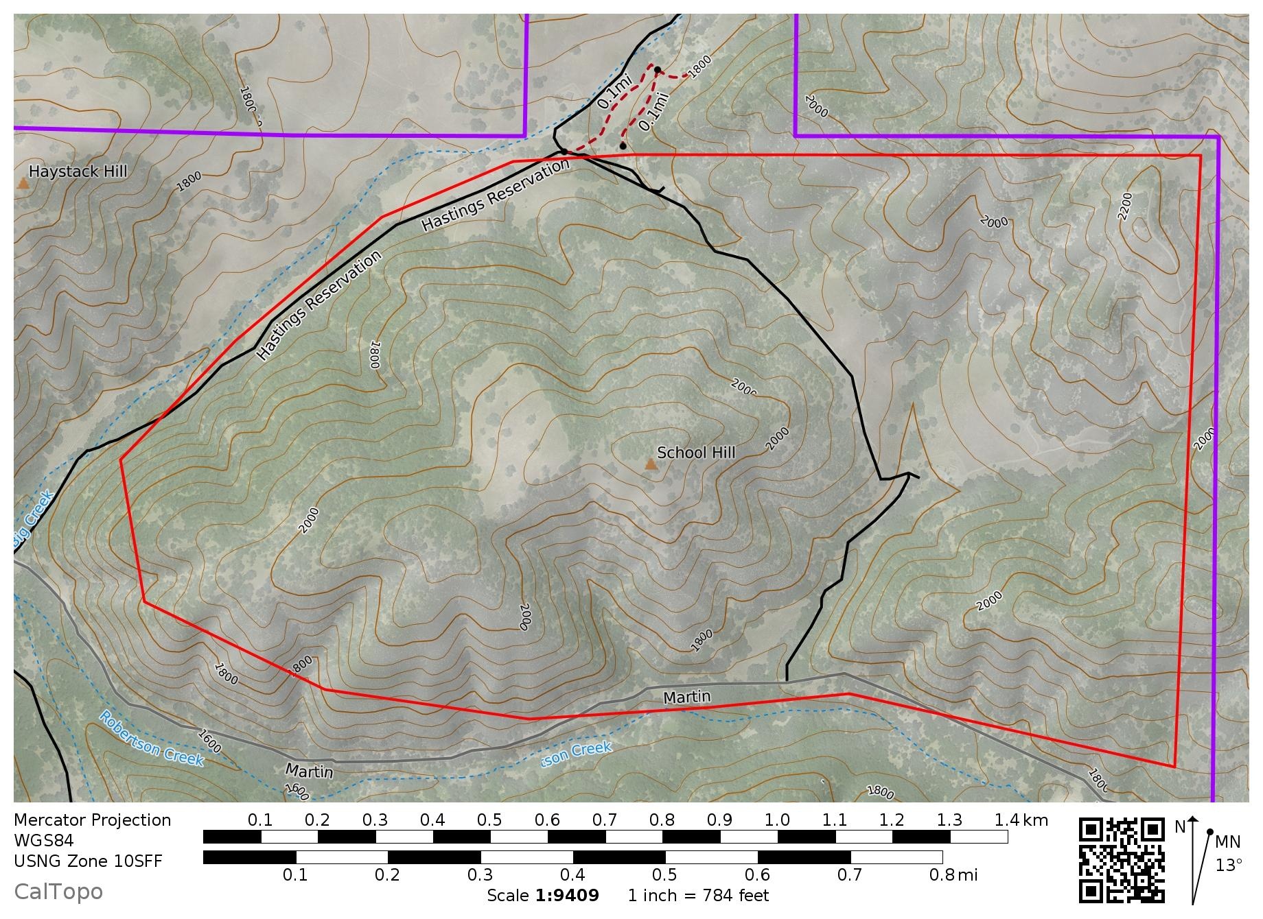
KMLs: study area (ver 2 for DJI Pilot) • hastings boundary
Maps: Google map • CalTopo map • Hastings topo map
Assignment
Explore the study area using the web map links above.
Download the KML of the study area (ver 2 for DJI Pilot) and load it into your flight planning app.
Select your drone in the app settings (e.g., Phantom 4 Pro).
How many flights do you need to cover this area?
Where will you launch from?
Use the app to design the flights. Save the project so you’ll be ready when you get to the site.
Tip: remember that the estimated flight time in flight apps generally does not include the time to get to the first way point.
Write-Up
If taking this for credit, complete the exercise worksheet.