DroneCamp 2021, July 26-30. More info.
Meet the Instructors
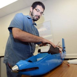
Sean Hogan
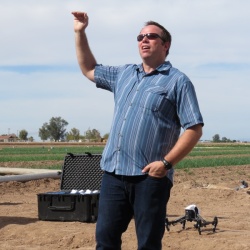 Dr. Sean Hogan is the founder and Director of the IGIS Drone Service Center. He has extensive experience in a wide range of UAS drone mapping and data collection projects, and is an expert on several drone platforms. He is also the UC ANR designated authority for drone operations. Sean developed the IGIS drone workshop model combining theory, equipment familiarization, regulations, hands-on flight practice, and data processing and analysis. Sean received his PhD in Geography at UC Davis. He was also a member of the UC Davis Center for Spatial Technology and Remote Sensing, providing GIS and remote sensing support for interests in precision agriculture, monitoring natural resources and calibration of NASA’s airborne imagers. His favorite drone is the eBee Plus.
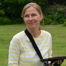
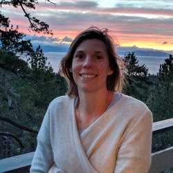
Maggi Kelly
 Dr. Maggi Kelly is a Professor and Cooperative Extension Specialist based at UC Berkeley. She is an accomplished geospatial data and analysis innovator. She has expertise in using data from spatial models, remote sensing, drones, lidar, historical archives, surveys, participatory mapping, and the field to gain insights about how and why California landscapes are changing, and what that change means for those who live on, use, and manage our lands. She is Faculty Director of the UCB Geospatial Innovation Facility (GIF) and Director of the ANR Statewide Program in Informatics and Geographic Information Systems (IGIS), both of which are dedicated to research, outreach and service in support of applied geospatial data and analysis. She holds a Part 107 Remote Pilot Certificate, and her favorite drone is the Mavic Pro.
Iryna Dronova
 Dr. Iryna Dronova is an Assistant Professor of Landscape Architecture & Environmental Planning at UC Berkeley. Her research and teaching focus on applications of landscape ecology to inform sustainable, multi-functional landscape-designs, and decision-making in environmental planning and natural resource management. Her group works in a variety of ecosystem types at scales ranging from the local to regional, with major efforts in the wetlands of the San Francisco Bay, Sacramento-San Joaquin River Delta, and urbanizing regions across the globe. She teaches a popular course on Applied Remote Sensing that focuses on strategies for working with different types of remote sensing data and extracting image-based landscape information for various environmental research and planning objectives.
Becca Fenwick
 Dr. Becca Fenwick is the Director of the Environmental Information and Technology Program for the University of California Natural Reserve System (UC NRS) and leads the statewide environmental and climate-monitoring California Heartbeat Initiative (CHI). Based at UC Santa Cruz, Becca manages a geographically-dispersed IT team who work with reserve staff, researchers, and the public to support all of the needs that come with using technology in the great outdoors. In partnership with researchers at Berkeley and UC ANR IGIS, Becca has been spearheading the development of CHI, a long term environmental monitoring program on the UC NRS and RECs using UAV’s, environmental sensors and satellite imagery to look at the health of the state’s ecosystems. CHI is currently funded by the Gordon and Betty Moore Foundation. Becca earned her Ph.D in Marine Geology and Geophysics from Scripps Institution of Oceanography (UCSD). Previously, she served as the Director of two UC NRS reserves (Yosemite, Sequoia-Kings Canyon, and James San Jacinto Mountains), and her favorite drone is the eBeeX.
Ali Moghimi
 Dr. Ali Moghimi is a postdoctoral scholar in the Digital Agriculture Lab at the University of California, Davis. He is passionate about conducting interdisciplinary research centered at the food-water-energy nexus. His current research focuses on developing and implementing innovative technologies (LiDAR and multispectral/hyperspectral imaging), automation (UAVs), and artificial intelligence (machine learning and deep learning algorithms) in agriculture to facilitate the digital revolution in agriculture. His favorite drone is Matrice 600 Pro.
Mallika Nocco
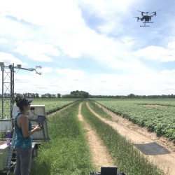 Dr. Mallika Nocco is UC Cooperative Extension specialist in the Department of Land, Air and Water Resources at UC Davis. Her research examines soil-plant-water relations to better understand irrigation management, water productivity, precision agriculture; drought/salinity stress management, feedbacks between irrigation and climate. She uses aerial imagery and now drones to measure agricultural water and salinity stress as well as evapotranspiration (water use). She earned her MS and PhD from the University of Wisconsin-Madison and is a 2017 David H. Smith Postdoctoral Fellow. Her favorite drone is a Matrice 210.
Alireza Pourreza
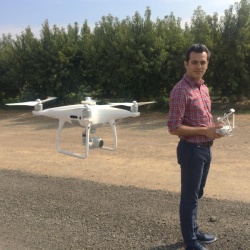 Dr. Alireza Pourreza is an Assistant CE Specialist of Agricultural Mechanization in the Department of Biological and Agricultural Engineering at UC Davis. His lab’s research is focused on Digital Agriculture, remote/proximity sensing, aerial data interpretation, and robotics and automation. His lab uses autonomous drones and advanced sensing systems for precise orchard/field monitoring, and site-specific crop management. He earned his MS and PhD in Agricultural and Biological Engineering at the University of Florida.
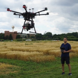
Andy Lyons
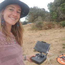
 Dr. Andy Lyons is Program Coordinator for the IGIS Program. He has a Part 107 Remote Pilot certification and supports IGIS drone projects through flights, data analysis, teaching, and development of open source tools for data management and mission planning. An alumni of UC Berkeley, Andy has taught classes at Berkeley and Stanford in population modeling, spatial analysis using open source software, cryptography, GIS, environmental problem solving, sustainability, African studies, and environmental narratives in science fiction film. His favorite drone is the Phantom 4 Pro.
Brandon Stark
 Dr. Brandon Stark is the director of the University of California’s Center of Excellence on Unmanned Aircraft System Safety, where he provides system-wide UAS expertise to all 10 of its campuses, cooperative extension network, field stations, and the UC’s Natural Reserve System. He is an expert on UAS technology, their use in research and commercial operations, regulations and policy, and risk assessment. He developed the UC UAS Safety Management System as an infrastructure to support and train UC staff, faculty and students for regulatory compliance, risk assessments and safety. He is also the chief policy writer for the UC system drone policy, and architect for UC UAS training programs and fleet management. As a grad student at UC Merced, Brandon built and crashed over 100 experimental drones.
Wing Cheung
 Dr. Wing Cheung is a Professor of Geography and GIS at Palomar College in San Marcos, California. In addition to his teaching duties, he coordinates the GIS, Drone Technology, and Environmental Studies programs at the College. He is the Principle Investigator of the NSF-funded UAS Operations Technician Education Program (UASTEP), and Assistant Director with the NSF-funded Geospatial Technology Center of Excellence.
Corey Garza
 Dr. Corey Garza is a professor of Marine Science at California State University, Monterey Bay. His research interests are in the area of marine landscape ecology. He uses GIS modeling and spatial statistics to study the relationship between scale dependence, habitat complexity and patterns of species distribution and abundance in marine communities. Dr. Garza serves as the principal investigator for the Marine Landscape Ecology Lab at CSUMB and, is the campus lead for the NOAA Center for Coastal and Marine Ecosystems (CCME). Within NOAA CCME he oversees coastal drone research for the center which focuses on mapping coastal habitats ranging from rocky intertidal communities to coastal estuaries across the U.S. West Coast.
Shane Feirer
 Shane Feirer is the head of the GIS Service Center within IGIS, where he manages dozens of GIS projects for UC researchers. Based at the Hopland Research and Extension Center, Shane has a broad background in GIS applications for natural resources. As an IT manager, he maintains GIS and remote sensing software for UCANR, and is the architect of an online drone data repository based on ArcGIS Portal. At Hopland, Shane coordinates a longitudinal post-fire vegetation monitoring program with repeated drone imagery. His favorite drone is the Phantom IV Pro.
Pat Iampietro
 Pat Iampietro is the Marine Geospatial Technology Officer at Cal State Monterey Bay. He administers and supports all geospatial software on the campus, represents CSUMB on the CSU GIS Specialty Center Board of Directors, and Chairs the campus UAS Safety Committee. With a background in hydrography | marine biology | GIS, he specializes in marine scientific instrumentation including MBES, sidescan, and sub-bottom profiling SONARs, still and video camera systems, ROV, USV, UAS, GPS and attitude sensors, scanning LiDAR, and other systems. His research primarily focuses on the use of terrain analysis in predictive species-habitat relationship modeling. He loves all drones equally.
Chippie Kislik
 Chippie Kislik is a graduate student in the Kelly Lab at UC Berkeley. Her research focuses primarily on the applications of unmanned aerial vehicles in terrestrial and aquatic ecosystems, with an emphasis on how multispectral imagery can identify nutrient and water availability in native oak species, as well as primary producers (algae & macrophytes) in the Klamath River. Chippie has a Part 107 Remote Pilot certification, and she loves to fly her Phantom 4 Pro drone. She is also exploring the capabilities of the Parrot Sequoia multispectral camera in her work.
Taylor Nelsen
 Taylor Nelsen is an Assistant Specialist in the Grain Cropping Systems lab in the Department of Plant Sciences at UC Davis. Her research focuses on nitrogen management using traditional agronomic methods in conjunction with new technologies such as proximal sensing devices, high resolution imagery and GIS. Originally from North Carolina, she has degrees in Environmental Science and Geography from UNC Chapel Hill, and a MS in Horticulture and Agronomy from UC Davis. When she’s not in the field, she teaches workshops in drone data processsing and analysis using open source software including R and QGIS.
Jonathan Rivas
 Jonathan Rivas is a fourth-year undergrad studying Computer Science and Engineering at UC Merced. He holds a Part 107 Remote Pilot Certification and gained the majority of his flight experience as a drone operator for the Mechatronics, Embedded Systems and Automation (MESA) lab at UC Merced, and the UC Center for Unmanned Aircraft System Safety. He holds a 107.29 exemption allowing him to fly at night and his operations vary from inspecting buildings and recording campus events to mapping out caves and detecting/monitoring invasive plant species. His favorite drone is the Mavic 2 Zoom.
Corey Snipes
 Corey Snipes is an aerospace software engineer, FAA-certified (Part 107) drone pilot, and OpenDroneMap contributor based in Cleveland, Ohio. He works across a variety of aviation software research projects from air traffic management to avionics to cybersecurity, many in support of the Federal Aviation Administration and NASA. His drone work focus is geomorphology and coastal resilience in the Great Lakes region. Corey is the president of the board of directors of the North Coast Drone Alliance, and oversees their meetups and public education events series. He is also the program chair for the Northeast Ohio GIS Symposium. Corey’s favorite drone is that trusty workhorse, the DJI Inspire 1.
Logan Ebert
 Logan Ebert is a Graduate Student Researcher in the Department of Land, AIr, Water Resources at UC Davis. His research looks at the use of remotely piloted aircrafts (RPAs) or drones to remotely collect data from agricultural fields. He uses this imagery to model water stress in the crops and provide decision support for irrigation management. He earned his BS from the University of Wisconsin - Stevens Point and is currently working on his MS at UC Davis. His favorite drone is a Matrice 210.
German Zuniga Ramirez
 German Zuniga Ramirez is a Staff Research Associate in the Digital Agriculture Lab at the University of California, Davis. As an Staff Research Associate, he has been in charge of operating sUAV to collect reliable aerial datasets (RGB, multispectral/hyperspectral, and thermal images) for projects that are seeking to revolutionize the use of novel technologies in agriculture. He has extensive experience in using aerial data processing software such as Pix4Dmapper. His favorite drone is the Matrice 210.
Robert Johnson
 Robert Johnson is a GIS Programmer and Analyst with IGIS. Based at the Kearney Research and Extension Center, he has a broad background in all things GIS and specializes in programming and custom application development. He supports IGIS drone projects through flight operations, data management, post-processing, and equipment maintenance and repairs. An expert with the new ArcGIS Pro, Robert has developed many of the exercises at IGIS workshops. He holds a Part 107 Remote Pilot License, and his favorite drone is the DJI Inspire 1.
Ben Erwin
 Ben Erwin is an ROV pilot and project manager for the Monterey Bay Aquarium Research Institute. In addition to operating deep sea robots, Ben manages MBARI’s interests in UAV’s and Virtual Reality applications for use in various coastal science endeavors. He is a part 107 licensed UAV pilot, and is experienced with building UAV systems and Photogrammetric processing workflows.
Meredith McPherson
 Meredith McPherson is a PhD Candidate at University of California Santa Cruz in Dr. Raphael Kudela’s lab. Meredith’s research focuses on using remote sensing techniques to study kelp forest systems in northern and central California, from UAVs to, which she became particularly interested in after unprecedented losses of kelp forest occurred in Sonoma and Mendocino Counties. Meredith conducted coinciding UAV and in situ diver surveys along the California coastline in 2019 to investigate spatial dynamics of kelp patches at multiple scales. Though there are challenges associated with mapping the coastal marine environment, these platforms provide a unique perspective and powerful toolset for studying spatial and temporal dynamics of kelp forest ecosystems that Meredith hopes will be applicable to monitoring and restoration.
Heidi Hirsh
 Heidi Hirsh is a PhD Candidate at Stanford University co-advised by Dr. Rob Dunbar and Dr. Karen Casciotti. Heidi’s doctoral research focuses on understanding the short-term impacts of kelp forest and seagrass community metabolism on the seawater carbonate system. The extent to which these communities can modify local biogeochemistry can help determine their potential to provide mitigation against ocean acidification. A marine biogeochemist by training, Heidi began conducting AUV surveys in 2017 to map seagrass beds in the Republic of Palau. Over the past two years, she has conducted ~monthly surveys of emergent kelp canopy at Hopkins Marine Station in Monterey Bay to explore temporal trends in canopy cover.
Alina George
 Alina George joined the FAA in March 2019 and is a Program Analyst in the UAS Office of Safety and Integration. She is one of the administrators for the UAS-CTI program. Before the FAA, Alina worked at Sparkfun Electronics, assisting with customer service, education, and outreach efforts. She also worked at RTCA, an aviation standards and regulatory body.
Diana Robinson
 Diana Robinson joined the FAA in early February as a Project Specialist in the UAS Office of Safety and Integration. Her focus is on Outreach and she is one of the administrators for the UAS-CTI program. Prior to the FAA, Diana worked for Manatee County Government as Energy Manager and implemented a UAS program during her time there. She has an MBA, a B.S. in Alternative and Renewable Energy Management and she is a Part 107 certified Remote pilot. Diana’s other experience included a full career at Oak Ridge National Laboratory (ORNL) where she spent the last 10 years at ORNL as an Environmental, Safety and Health Compliance trainer.
Dale Hylton
Dale is a veteran of the drone industry with nearly 6 years working with retailers, scientists, service companies and manufacturers to help bring drones to the forefront of commercial use. He is a Manned Pilot along with a Remote Pilot and has flown a variety drones from multi-rotors for versatility to fixed wing and VTOL drones for long distance flights. His experience includes the use of sensors that collect multi-spectral imagery for vegetation analysis in farming and scientific research to LiDAR (lasers on drones!) for mapping topography and aggregate analysis along with gas detection and thermal sensing. As a business development director Dale has helped retailers and manufacturers grow in the ever-changing drone space.
Drew Baustian
Drew has been in sales with MicaSense since 2016–his past experience includes sales at an ag-tech startup, installation & support for a precision ag dealer, field scouting for a seed company, and growing up on a corn, soybean and hog farm in Iowa.